Wednesday, Notre Dame will host its fifth annual Geographic Information Systems (GIS) Day, exploring the ways research at the University can benefit from the technology and resources organized by the Geospatial Analysis Laboratory (GAL).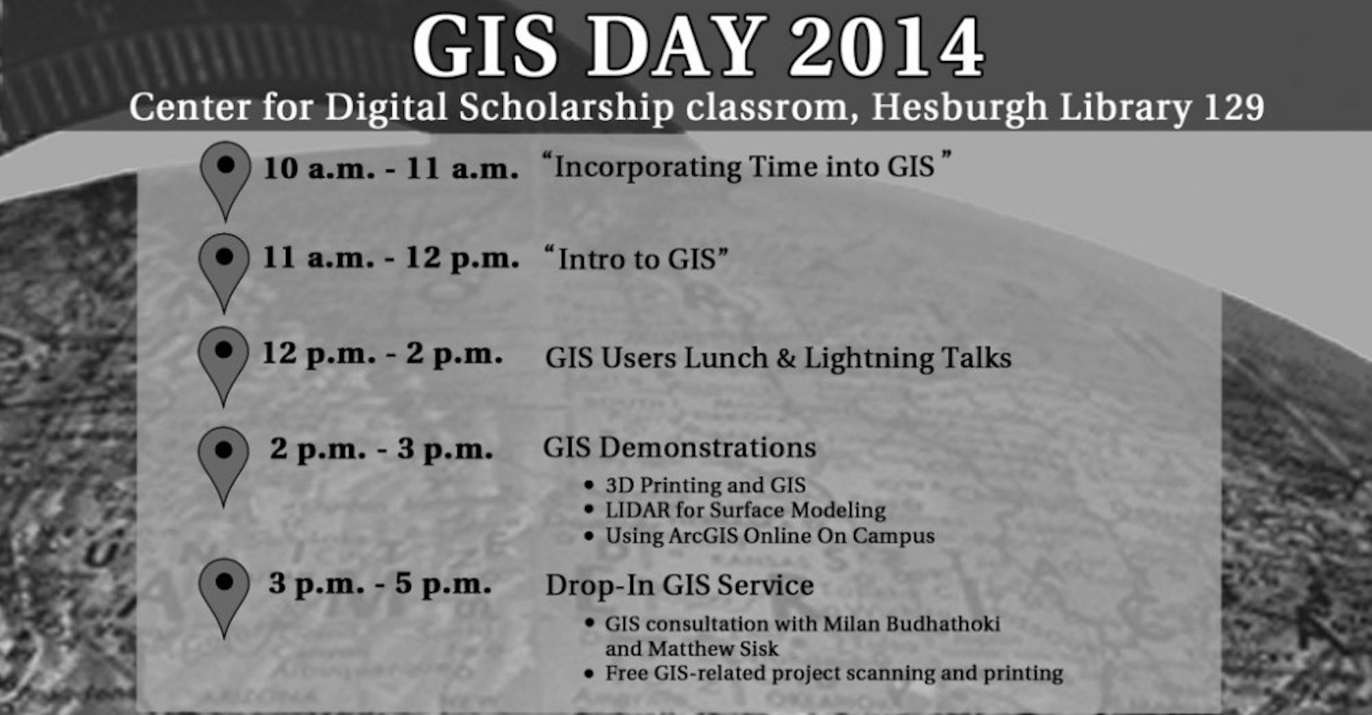
Matthew Sisk, a postdoctoral fellow in the University's Center for Digital Scholarship, works closely with the GIS system on a daily basis, helping students and faculty to better understand the technology.
“Basically, it is computer mapping software that lets you incorporate location into existing data,” Sisk said. “Think Google Maps with a whole lot more.”
With this sort of technology, eventually researchers hope to create maps that are interactive and demonstrate a change in data such as population or weather patterns over the course of time, all on one interface.
“This is one of the best platforms where a GIS user can learn from another user through knowledge exchange, workshops and training,” Sisk said.
As a co-organizer for the event, Sisk said he is excited about the lightning talks featured throughout the day, which will showcase the wide variety of ways researchers on campus use GIS. The day will also feature several different events, ranging from a series of workshops to quick talks about campus research and demonstrations of tools like 3-D printing and high resolution topographic data.
Milan Budhathoki, another organizer and GIS specialist, currently leads a lab in Innovation Park where GIS resources are often utilized.
“This day is one of the best platformd where a GIS user can learn from another user through knowledge exchange, workshop, training, etc.,” Budhathoki said. "This is a big day for professionals who are in GIS industry, and for me.”
Attracting students from all disciplines, including biology, political science, peace studies and architecture majors, GIS day offers an extremely unique opportunity to learn about a relatively new technology, Budhathoki said.
“I have seen that there are good numbers of ND faculty, researchers and students using GIS technology in their research and teaching to make a difference in the world,” Budhathoki said. “Application of GIS in research here on campus ranges in wide disciplines including social sciences, biological sciences, engineering, public health, etc. So this event will facilitate to bring users from diverse intelligence to a common room to share their GIS work.”
Taking place all day in the Center for Digital Scholarship, GIS day provides a unique chance to interact with cutting-edge technology, Sisk said.
“This is a great opportunity to learn about the types of research that this powerful tool can help with, to see how others are using it on campus and to tour the Center for Digital Scholarship and find out about the tools, technology and people that can help with research here at Notre Dame,” he said.


